Thursday 31 October 2013

More autumnal glories, and routes...

We certainly hit the jackpot with the weather for the week. On the last day Martin and I were sitting on the steps eating lunch, and it seemed rather warm: a thermometer in the sun clocked the temperature at 37C - not bad for late October, and certainly better than what was on offer in England.

Anyway, some routes cycled this time.

Firstly a rather hilly one cycled with Arved: two hardish cols (Col de la Chaudière and Col de Pennes), and though only 72 miles, Ridewithgps clocks 12,000ft of climbing. Even if that is an overestimate, it was a properly tiring ride, and the climb to the Col de Pennes via the longer southerly route was taxing, though really worth it for the amazing scenery it goes through. Incidentally, not one car passed us from the Col de Lescou to the Col de Pennes, 20 miles in all.
http://ridewithgps.com/routes/3611751

Secondly, a short route round the Vercors plateau. Three highlights: the climb and descent to/from the Col de Rousset (a perfect gradient in both directions, which took me 57 minutes up and 25 minutes down); the Grands Goulets, the most bonkers balcony road you're ever likely to find; and the lush meadows spread out between the mountains of the plateau.
http://ridewithgps.com/routes/3611827

Our one aborted ride was going to go over the Col de Grimone and back via the Col de Menée (similar, in reverse, to my ride to Mens in August), but the Col de Menée was closed, and given the windiness (gusts up to 60km/h) Arved & I returned via the unexpectedly amazing Cirque d'Archiane.

Photos below from the three rides.

Arved at the Col de la Chaudière
One of the Trois Becs, from the Col de la Chaudière
Les Grands Goulets

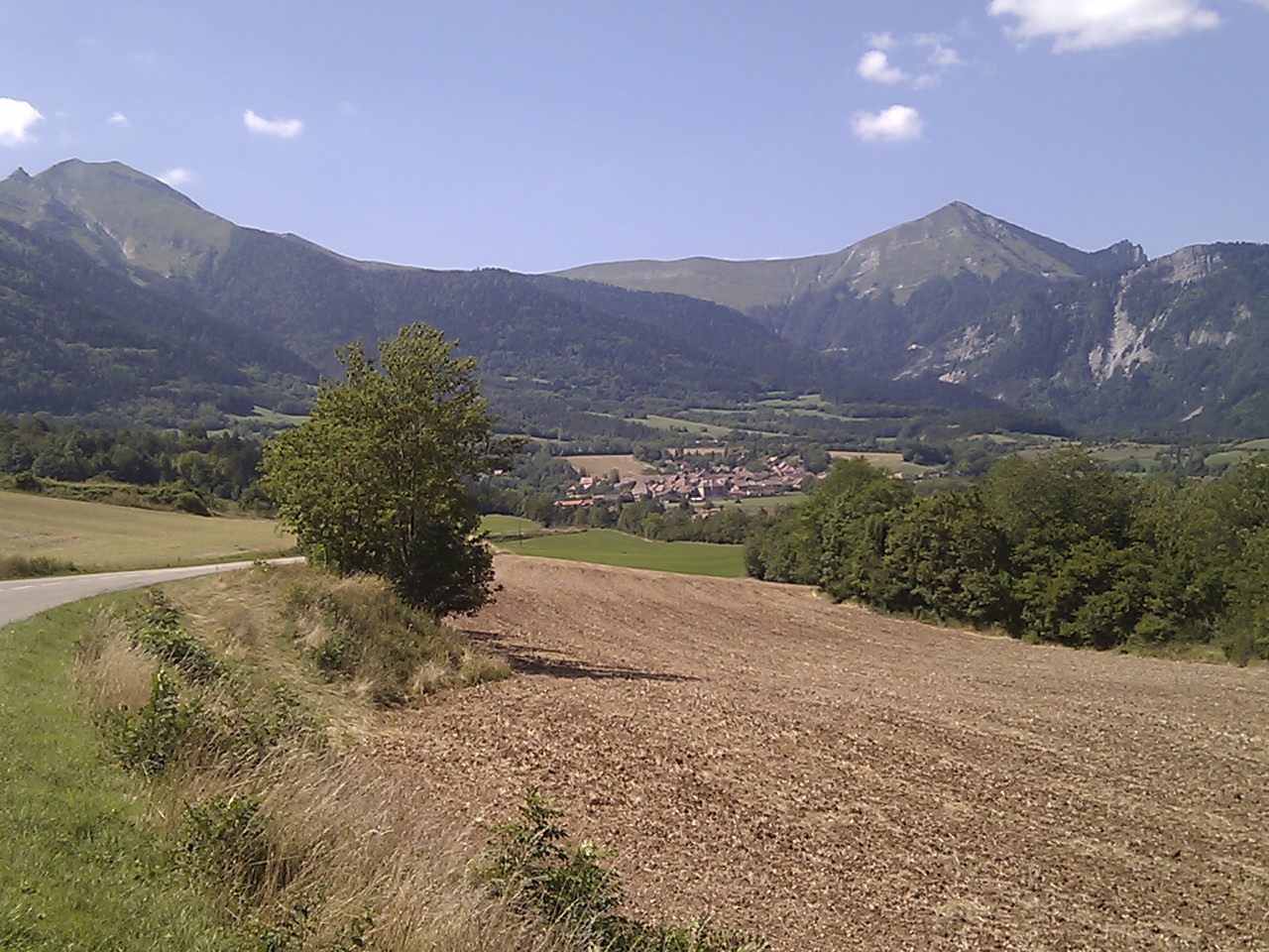
On the road back to St Agnan-en-Vercors
A salamander outside my house
Riding done, the Super Six is put to bed.

Wednesday 23 October 2013

Autumnal excursions and colours

A week ago I had my normal glance at the Villard-de-Lans webcam to see what I assumed to be a software glitch, as all I could see was snow. But no, the date stamp was up-to-date, and there had indeed been a big snow dump overnight. However, generally very mild weather has been the norm this Autumn, and by the evening nearly all the snow had gone. And I gather that such great variation is to be expected, so I was prepared for anything for my week's October stay - though, of course, hoping for some warmth and some cycling-friendly weather.
Well, so far,so good: daytime temperatures up to 24C in the shade, though also with dramatic Alpine storms.
I don't know if this year's weather has made the autumnal colours especially spectacular, but certainly, for my first October visit, the scenery is perhaps even more breathtaking than in the Summer.
Below are photos from today's ride up to the Col de Grimone and back via the Cirque d'Archiane (a most dramatic valley indeed). The top photo is from yesterday's ride to Gigors, and shows Alpine newbie Martin Wright coming over his second Col, the Col de la Croix, with experienced Alpinist Arved Schwendel.
The walnuts were collected from a roadside ditch by Arved and me, on the way back through Châtillon-en-Diois, and the last four photos are from an evening stroll up behind my house towards the Glandasse, dodging some very heavy showers!

Saturday 14 September 2013

A few local loops

One of the joys of the area around Die is the ability to make up so many different types of route, from day-long epics, to quick there-and-back training loops. I'll add some more epics in due course, but if you're in the area, and you'd like some ideas for shorter rides, here are a few of the ones I've done, mostly in the 90 minutes to 3 hour range.

I'll start with a virtually pan-flat 39-mile course west to Aouste along the D93 - this would make a great time trial course, as there are relatively few junctions, great road surface, and a roundabout each end: http://ridewithgps.com/routes/3350037

Next up - one of the first rides I did in the area, with a nice climb, some beautiful views and a long fun descent (watch for a few of the earlier corners on which you might need to back off top speed in case of traffic coming the other way): http://ridewithgps.com/routes/3350119

Heading out east, there are a few nice loops. Firstly, a nice short one (7 miles) to Pont-le-Quart: http://ridewithgps.com/routes/3350119. Secondly, 16 miles out to Recoubeau: http://ridewithgps.com/routes/3350144, and thirdly an extension of that to Luc-en-Diois, with some nice rolling downhill sections on the return: http://ridewithgps.com/routes/3350155

If you want to do some reasonably serious climbing, here are two routes. Firstly, 32 miles to the Col de Pennes: http://ridewithgps.com/routes/3350170 - the ascent is about 2500ft, and though the descent isn't suited to great speed, you'll get some stunning views of the Drôme valley and right over to the high Alps. Secondly, the classic Col de Rousset: http://ridewithgps.com/routes/3350187. If you haven't done a full-on alpine climb before, this is a good start - about an hour's climb (my best time so far is 57'30") with no difficult sections (nothing over 10%), and a really nice descent. If you can do this, you can do Alpe d'Huez. And the view at the top is breathtaking.

View from the descent from Col de Pennes


View from the Col de Rousset


Tuesday 3 September 2013

Three classic routes

As time goes on I'll post as many of the routes that I've done as I can, both as an aide memoire for me, and as a resource for other cyclists using Die as a base. This time round there are three new routes, in each of which I wanted to try out some roads new to me, and to create some 'classic' rides. I was pleased with each, though the credit for that goes to the superb scenery and roads round here.

The first route is the one I did with James Morrison up the Gorges de la Bourne. A couple of notes - I think we missed a nice little bit of balcony at Les Goulets, as an alternative, just before the long tunnel after La Chapelle-en-Vercors; and you can take an alternative route down from Villard, by cutting over the hills instead of going back down part of the gorge. Try to do this when the weather up on the Vercors is going to be good: it can be really unpleasant up there while Die is baking in the sun all day.
 91 miles, Die - Gorges de la Bourne

Next was this solo effort, in which I wanted to get views of Mont Aiguille and the high Alps. Only four cols, but a cracking ride, with the added bonus of the Gorges des Gâts.
78 miles, Die - Col de Menée - Mens - Col de Grimone

Lastly, a bit of a toughie, starting with Col de la Chaudière, but a great mix of scenery. 

Don't take the elevation data too literally: you'll notice that Ridewithgps can't handle tunnels or snaky gorges at all well, so climbing totals get severely exaggerated where there is much of either. That said, these are all routes where you'll want some decent climbing legs and food to power you over the cols. There were no problems finding water to top up bottles en route.

Saturday 31 August 2013

French road signage

I like maps. I definitely like maps, and prefer them any day to GPS systems. I'll admit I've never used GPS on my bike, though I've used it on Dartmoor walks: having got over the novelty, and marvelled at its precision,  I realised that I was more concerned about reaching my waypoints than taking everything around me, despite using it with a good map. I'll still take it with me on Dartmoor, but just for safety, and not general navigation - it stays turned off, unless the need arises. And I'll not deny that a bike GPS can have its uses, particularly in unfamiliar big towns, where signage can be erratic and junctions frequent.

But round here there is simply no need for GPS: the towns are not large, and more importantly, the signage is so good that a decent map and the signs are enough.

Firstly, the maps: though I've moaned about the paper quality, the IGN 1:100,000 series is ample for cycling, though their elevation data is a bit sparse, and you have to learn to read 'between the lines' if you don't want to get caught out with more climbing than you anticipated.

Then there's the signage round here - it's pretty comprehensive, once you know where you're going. Firstly, there are the general road signs, which always give distances and road numbers. (Note: occasionally a road will have two numbers, if two 'routes' share the same road, though there's only the Grenoble to Gap road round here that I can think of that does that.) Secondly there are the incredibly useful km markers along all but the smallest roads, that give distance from the starting point of the road, distance to the next place, and sometimes elevation and % gradient for the next kilometre. And lastly, there are the river and col signs that can confirm that you're definitely where you should be.

The point is that if you use a map and your senses you'll get a much better sense of the geography of wherever you are: not just the narrow strip on which you're riding, but also the rich landscape around you. And boy, there's some rich landscape round here.

Photos below come from today's southerly ride, down to Dieulefit, across to Trente Pas, and back up to return via the Roanne Valley. A pretty awesome ride, both physically and geographically.

Thursday 29 August 2013

French fountains

If you've done some cycling in southern France, you'll know how welcome the sight of a village or town fountain is. We're not talking about some merely ornamental carbuncle, but something of real practical use for a parched cyclist. For the real French fountain is where you can fill up your empty water bottles, drench yourself in cool water, or rinse your washing (if you've had the foresight to bring your laundry with you).

Certainly in these parts it is unusual to pass through even a small settlement where you can't find some public source of 'Eau potable'. Indeed, it's so much the norm that it's pretty safe to assume that any water running into a trough in a village or town is 'potable' unless it specifically says it's not. (See photos below).

Having said that, I'm not sure how far south you have to come before that assumption is safe: last summer I got caught out by a fountain in some anonymous central French town, as I cycled from Exeter to Die (see how I sneaked that in there): it looked all the world like the examples down here, but I guess the slight green tinge should have alerted me. Well, the taste certainly did, and having spat it out, the nearby café provided water, but only after checking that I'd bought a coffee. Harumph.
The reference to washing wasn't entirely made for comic effect. I actually spoke briefly to an old lady in Sainte Croix (near Die) who was in the process of doing some washing in the trough. Which brings me to the bit of advice to fill your bottles direct from the piped water, unless you particularly enjoy the taste of old ladies' washing, and probably rampant French bacteria and parasites.

I'd be interested if anyone knows where the 'Eau potable' assumption is a safe one. All I know is that it's both reasonably safe, and very welcome down here.

Pictures below are of three examples from a ride today. Firstly a massive (40ft long!) trough in Cléon d'Andran, with a clear 'Eau non potable' sign; one from Bourdeaux (check the spelling), the 'Eau potable' sign probably there because there's another fountain just 50 yards away; and two examples from Saillans - the first is one of my favourites, as it's a good example of the attractive AND functional fountains you sometimes find.

Tuesday 27 August 2013

Mad French roads: gorges.

I guess that the French like challenges. Well, certainly the road builders do, if examples in these parts are anything to go by. You might have read about the Gorges de la Bourne in a previous posting, but that's a far from isolated example. I guess that with the nature of the terrain in the mountains, you either have to go through them (the French are quite handy tunnellers too) or round them, and the latter usually involves following an Alpine water course, and in doing so, a certain amount of flair is called for.

The Gorges de la Bourne is one of those late 19th-century balcony roads that seemed to be as much about the problem-solving engineering as about the need to get from A to B. And I'm not sure what the economic case for building the Gorges des Gâts was (it was built in 1910) , and though it's maybe not a classic balcony road (much of it runs along the bottom of the gorge), it's certainly a roller-coaster ride. This time I rode there specially to take photos - I hope you appreciate the dedication to duty!

At the end of the photos there are a couple of shots from the ride back, and an apparently unloved little col: the Col de Miscon. No official sign there, but a rather sad little hand-painted one. OK, a 1023m col in these parts is hardly worth mentioning, but given that it's not far off the highest point in England, I thought I'd give it a little moment of glory. Well, if a paragraph in some barely-read blog can achieve that, that is.

Sunday 25 August 2013

Diois weather

I'm not going to deny that one of the main attractions of the Diois region is the climate. Devon, in English terms, on average, does fare well in comparison with the rest of the country. But averages only tell part of the story, and we've had an extended poor run of summers for several years now, and the forecasters say that that might be the norm for a while yet.

Well, at the risk of sounding a little morbid, I occasionally muse on how many summers I've got left in which I can make good use of the reasonably fit and active body I'm fortunate enough to have. Will I be able and keen to go up Alpe d'Huez in my seventies? Possibly yes, but I'd rather be getting in the riding and general enjoyment of the outdoors now, in decent weather. And decent weather has been in short supply. (That's assuming that decent weather includes reasonable doses of sunshine and warmth - though I'll grant that it's not to everyone's taste.)

Anyway, back to Diois weather, and those fallible averages: on average, Die has the same amount of rain as Devon, but about 800 more hours of sunshine. Yep, 800. That's nearly 50% more. Even if you distrust statistics, that's likely to be noticeable. And so it was last summer, with both of my visits seeing plenty of sunshine, while Devon was suffering storms and flooding. Not to mention temperatures of 39C during the August stay.

"But," I hear you say, "if it's so sunny, how come they have as much rain as Devon?" Good question - I'm glad you asked. Well, if you've seen an Alpine storm, you'll know how. An "orage". Rain like you"ll rarely see in England, but seen regularly here, especially at certain times of the year.

Well, one was forecast yesterday, and it came. There was no missing it. Thunder rolling around for an hour, lightning flashes getting closer. Then suddenly the wind went mad for five minutes, and all the mountains disappeared behind a wall of rain. The wind stopped, but it carried on raining for an hour. Then it stopped, and warm sun came out and there were clear blue skies. Time for a quick ride. But the showers were still about, so time to  close the shutters for the night. When it rains here, you understand why French houses have shutters. Incidentally, we'ce had two rainy days here so far in August. Most of the rest of the time it's been sunny. They're getting their 800 extra hours, it seems.

Only two photos: one post-thunderstorm during the snatched ride; the other, an incendiary evening sky.

Home alone - time to ride the bike, I think.

Well, after a memorable meal at L'Aubergerie at Barnave, an early departure the following morning for the Morrisons saw them load up the car and bikes and hit the road back to Blighty. They were the perfect guests, and the time flew by in a stream of riding, eating, the odd beer or two, and lots of card games. But now they had gone, and what to do?

Ride a bike, of course. I've covered a lot of the roads round here now, and though there's not a single duff one, and I'm happy to repeat any route, I'm still on the look-out for new roads and routes for me.

So, in the photos below you'll see photos from two new rides. The first started of with a familiar ride over the Col de la Croix and down the Gervanne Valley, but then I detoured on to Gigors, and its lovely elevated position, before heading back to Die via the main road - always good training for just pumping out the miles.

The second ride is another classic, I think. From Die I headed out over the 1454m Col de Menée, on the descent from which you get great views of the amazing Mont Aiguille. After Mens I returned via the Col de la Haute Croix and Col de Grimone. And the stunning extra is then the Gorges de Gats - unlike the Gorges de la Bourne, this road sits right at the bottom of a deep ravine, complete with tunnels. Sorry no photos of the Gorges though - but I'll be back there again, for sure.